
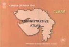
Census of India 2001: Gujarat Administrative Atlas
Contents: Foreword. Preface. Acknowledgements. I. State: 1. Position of Gujarat in India 2001. 2. Administrative divisions 1951. 3. Administrative divisions 1961. 4. Administrative divisions 1971. 5. Administrative divisions 1981. 6. Administrative divisions 1991. 7. Administrative divisions 2001. Thematic maps: 8. Decadal growth of population 1991-2001. 9. Distribution of population 2001. 10. Density of population 2001. 11. Sex ratio 2001. 12. Sex ratio in age-group 0-6 2001. 13. Literacy 2001. 14. Female literacy 2001. 15. Growth of towns 2001 (Class-I, II & III). 16. Growth of towns 2001 (Class-IV, V & VI). 17. Main workers 2001. 18. Regional divisions 2001. 19. Population statistics 2001. II. District and Taluka: 20. Changes in administrative boundaries 1991-2001. 21. District Kachchh. 22. District Banas Kantha. 23. District Patan. 24. District Mahesana. 25. District Sabar Kantha. 26. District Gandhinagar. 27. District Ahmadabad. 28. District Surendranagar. 29. District Rajkot. 30. District Jamnagar. 31. District Porbandar. 32. District Junagadh. 33. District Amreli. 34. District Bhavnagar. 35. District Anand. 36. District Kheda. 37. District Panch Mahals. 38. District Dohad. 39. District Vadodara. 40. District Narmada. 41. District Bharuch. 42. District Surat. 43. District the Dangs. 44. District Navsari. 45. District Valsad. Bibliography.
Get it now and save 10%
BECOME A MEMBER


Bibliographic information