Logo

0
Your cart is empty empty bag

Free Worldwide Delivery on orders over $50

Х

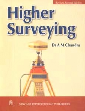
Higher Surveying

 
A M Chandra (Author)
Synopsis

This book presents a systematic and contemporary treatment of the theory and applications involved in higher surveying. It also highlights some of the modern developments in geomatics.

After explaining the basic survey operations, triangulation and trilateration, the book describes the various adjustment methods applied to survey measurement in detail, which is followed by topographic, hydrographic, construction, and route surveying. As engineers and surveyors need knowledge of determining absolute coordinates of points and directions of lines on the earth's surface, a detailed discussion on field astronomy is presented in this book. A chapter on map projection is also included in the book.

Recent advances in land surveying are then highlighted including photogrammetry and photographic interpretation. Remote-sensing technique utilizing data acquired through satellites is also explained.

Recent instrumentation techniques and methodologies being used in geomatics are emphasized. These cover a range of modern instruments including EDM, total station, laser-based instruments, electronic field book, GPS, automated photogrammetric systems, and geographic information system.

A Large number of worked-out examples, illustrations, and photographs are included for an easy grasp of the concepts.

The book would serve as an excellent text for Civil Engineering students, AMIE candidates, and surveyours. Practicing engineers would also find it extremely useful in their profession.

Read more
27.00 24.3 $ 30.00 $
Free delivery Wolrdwidе in 10-18 days Ships in 1-2 days from New Delhi Membership for 1 Year $35.00
Get it now and save 10%
Members SAVE 10% every day
BECOME A MEMBER
About the author

A M Chandra

Dr. A.M. Chandra is presently working as Professor of Civil Engineering at the Indian Institute of Technology Roorkee, Roorkee (formerly University of Roorkee). He graduated in Civil Engineering in 1969, completed postgraduation in Advanced Surveying and Photogrammetry in 1971 and obtained Doctoral degree in 1984 from University of Roorkee.

Dr. Chandra joined the Civil Engineering Department of the University of Roorkee in 1975 after serving for brief periods at S.V.R.C.E.T., Surat, as Associate Lecturer and as Assistant Engineer in R.E.S., Uttar Pradesh. He also served at University of Salahadin, Arbil, Iraq and Arba Minch University, Ethiopia.

At the University of Roorkee, Dr. Chandra has been engaged in teaching, research and consultancy activities in the field of Land Surveying, Photogrammetry, Remote Sensing, and Physical Geodesy. Dr. Chandra has published several research papers in national and international journals and conference proceedings. Dr. Chandra has been to Austria for a brief period and attended an international course on Mathematical and Numerical Methods in Physical Geodesy.

Read more
Write a review
Reviews 0in total
 

Bibliographic information

Title Higher Surveying
Author A M Chandra
Format Softcover
Date published: 16.08.2012
Edition 2nd ed.
Language: English
isbn 9788122416282
length 424p.